Drone Progress Tracking for Construction and More
Stay ahead of your construction schedule with our professional drone progress tracking services. Designed for construction clients who demand accuracy, efficiency, and speed, our service provides detailed aerial documentation to keep your project moving smoothly.
Our state-of-the-art drones capture high-resolution imagery and data, delivering a clear, comprehensive view of your site's progress. From large-scale developments to intricate builds, we ensure your team has the insights needed for better decision-making. Aerial photography and video helps to quickly identify problem areas, bottlenecks in scheduling, safety hazards, and even equipment that is not meant to be on site any longer. All of these issues waste time and money.
Let our drones save you money! Beyond the issues above, we also save our clients time from pesky investors asking about project updates and save a ton of money on travel costs. We have had several clients comment about reduced costs related to traveling to and from job sties less often. Furthermore, some clients state how nice it is to stay focused on work instead of answering calls about updates on the project. We host everything exactly how you need so that clients and management can view updates at all times.
Need results fast? We offer expedited service with rapid data processing and expedited turnaround for an additional fee. Whether you're addressing tight deadlines or tackling unexpected changes, we’re here to help you stay on track without compromising quality.
Solid Flight Media also provides several extra bits of data completely for free. All scans include tiff files which can be opened inside of any GIS software. This allows our customers to view geo locations, calculate distances, measure areas, and much more. All scans will also include a detailed PDF report showing a summary of our work during each visit.
We are always working to improve our data collection and provide even more accurate collection with our drones. We are working to gain higher accuracy with out mappings and to offer even more data for our clients.
Please not that the price given is just a quotation and the price show is the price PER FLIGHT SCHEDULED. This quote is just to start the reservation process for our flight time and to start the process of finalizing drone services with Solid Flight Media. All final prices may be subject to change based on the scope of the project or any additional requirements.
This package comes with the following included:
One 2d Mapping of the entire location (farm land, job site, property, etc.)
At least 25 Individual Photos of each Location (based on size)
One short video of the location (unedited)
One Data report of all media
Additional addons can be purchased separately depending on the size of the job:
Materials Pile Volumes
Edited Video Media of The Site

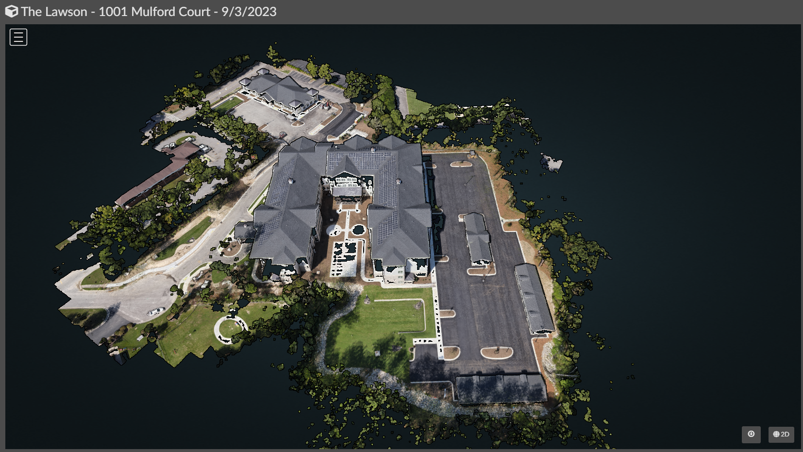 Image 3 of 7
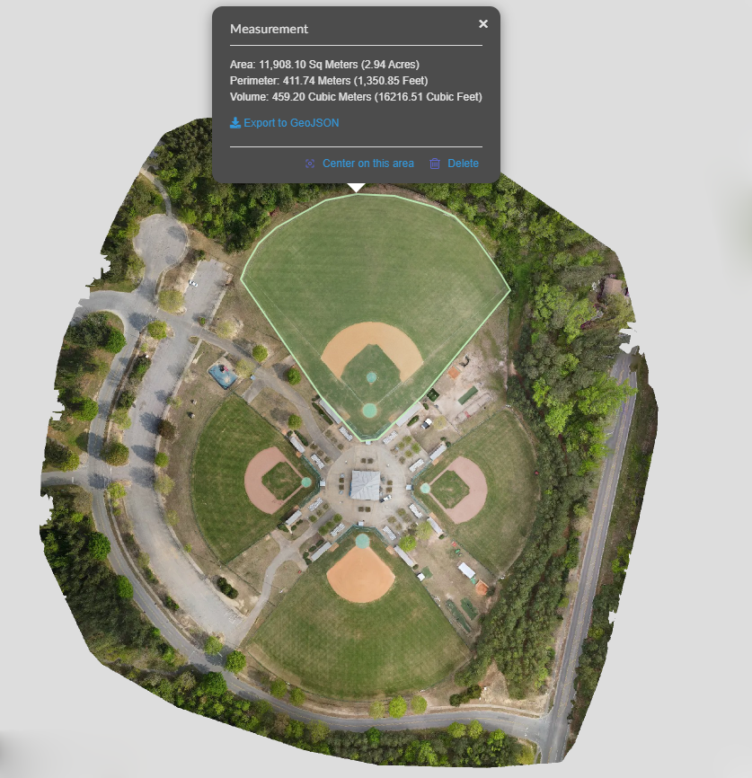 Image 5 of 7
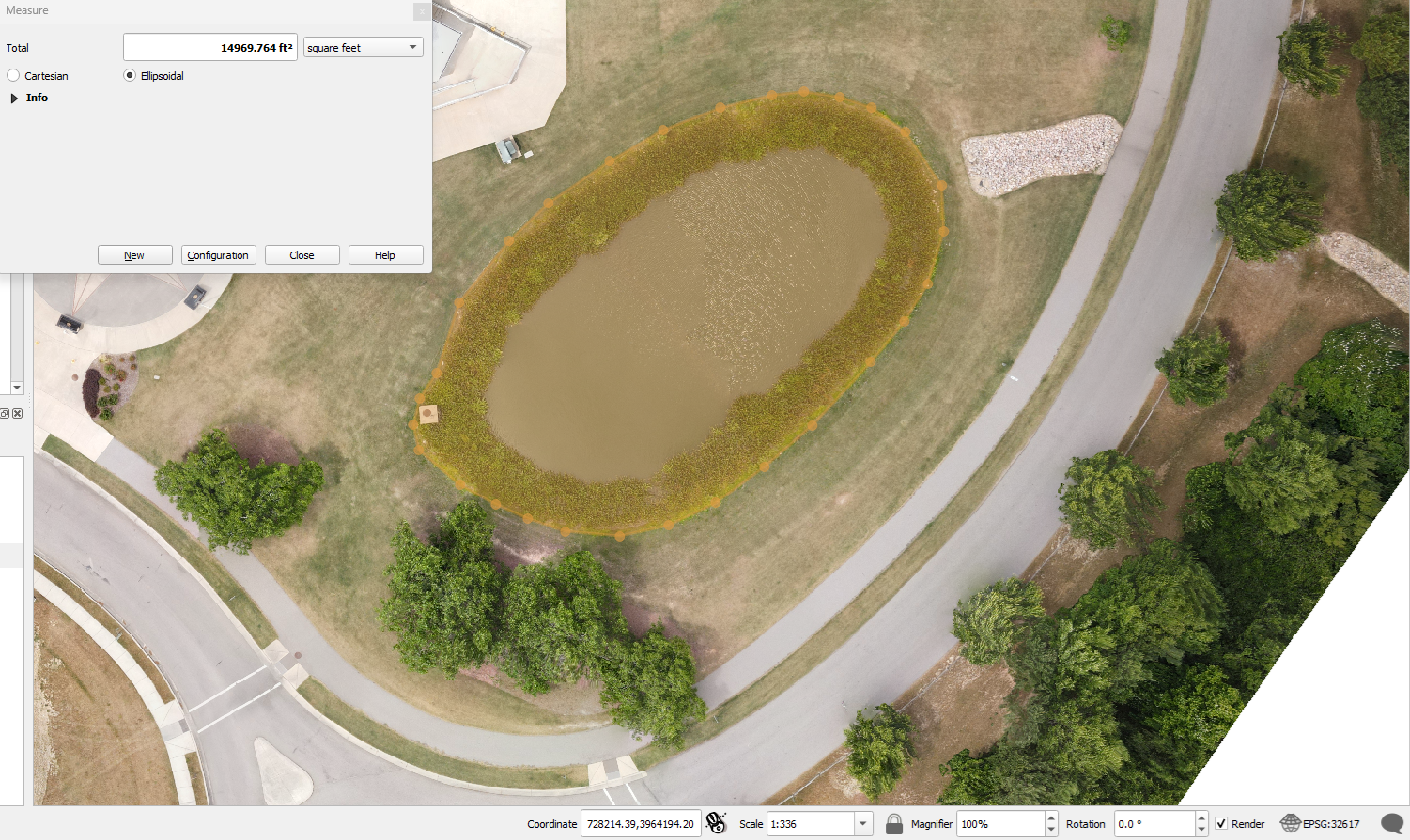 Image 7 of 7